Background
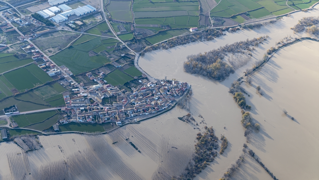
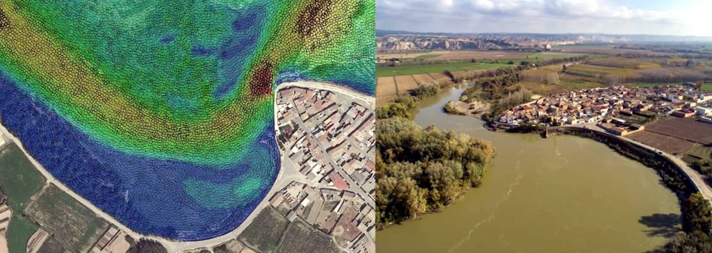
Cabañas de Ebro is located on the banks of the Ebro, on the outside of a large meander. Historically, the Ebro flooded the meander located in front of the town, so that the waters did not reach great height or speed.
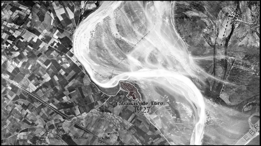
During the 1960s to 1990s, the Ebro River flood defense dykes were built. In the case of the town of Cabañas de Ebro, the defenses of the upstream section of the town are shaped in the form of a funnel (see figure 2), so that the flowing waters are forced to travel the entire perimeter of the meander, which means passing in front of the defenses of the urban center.
This circumstance favors overflows towards the outer part of the meander, by increasing the height of the circulating waters, and increases the erosion processes in the bed of the riverbed in this area, where the urban center is located.
To mitigate these effects, the town’s defenses have been gradually reinforced with the construction of breakwaters, walls and defense dikes, which have been reinforced or rebuilt after each flood event.
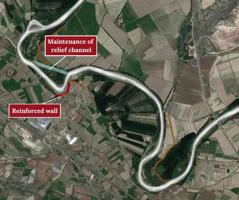
Following the major floods of 2015, the west defense dike of the town center was reinforced, the perimeter defense of the meander in front of the town was lowered and a relief channel (artificial river arm that comes into operation during floods) was built to reduce the amount of water flowing in front of the town’s defenses.
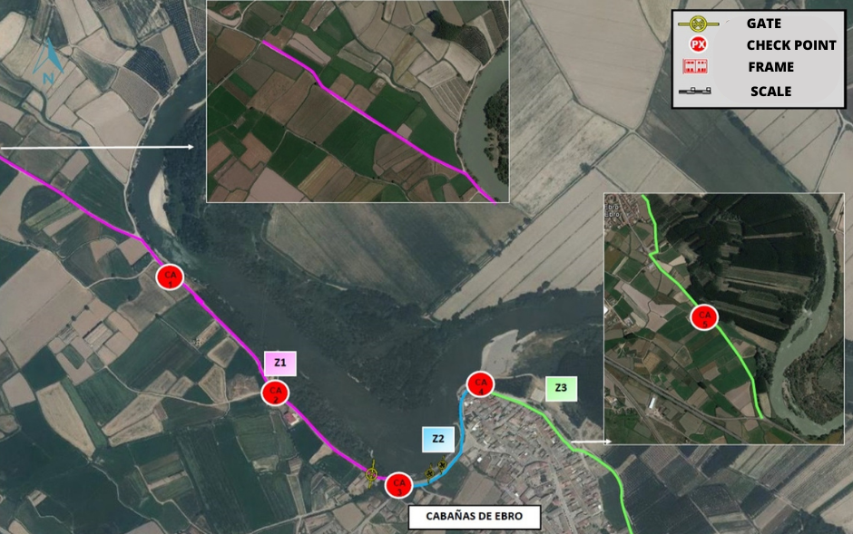
A population security perimeter was delimited in 2017. This safety perimeter consists of the delimitation of the defense structures of the urban core, their leveling, their preparation to be able to carry out emergency works with guaranteed safety and the construction of a system of milestones marked with a scale, which serve to control the levels of the avenue and help in monitoring its evolution and decision making.
Similarly, after the 2018 flood, the main defense wall of the urban area was reinforced and part of the breakwater (a structure made up of large stone blocks) protecting the wall, which had been lost, was replaced.
At present and after these interventions, Cabañas de Ebro is protected for floods with a return period (average time it takes for a flood of similar flow) of 10 years, according to the hydraulic studies carried out.
On the other hand, a similar phenomenon occurs in the meander located between Cabañas de Ebro and the bridge over the Ebro on the A-126 road from Alagón to Tudela. In this case, the defense dikes around the perimeter of the meander could not be fully consolidated and are in a different state of preservation. However, recent floods have increased the erosive processes on the outer bank of the meander and it is likely that in the short term the integrity of the VP-24 road, from Alagón to Gallur, will be endangered as it passes by this point.
Objectives of the study
Within the scope of the Ebro Resilience Strategy, a total of 260 kilometers of the Ebro River are being studied, divided into 15 sections.
Section 8 is centered in the town of Cabañas de Ebro and covers the 4 km of the riverbed before the town and the 4 km after, approximately, ending at the A-126 road bridge over the Ebro River.
The specific objectives of the study were as follows:
- Evaluate the level of protection of the urban area of Cabañas de Ebro for floods with a return period of 25 years and propose actions to prevent flooding, should it occur.
- Analyze the erosion processes of the local defenses and propose actions to reduce them in the event that these processes are observed.
- Reduce the likelihood of damage to the VP-24 highway.
- Reduce the risk of flooding in non-urban areas by reducing the speed at which water flows and/or the height that floods reach over fields.
Work performed
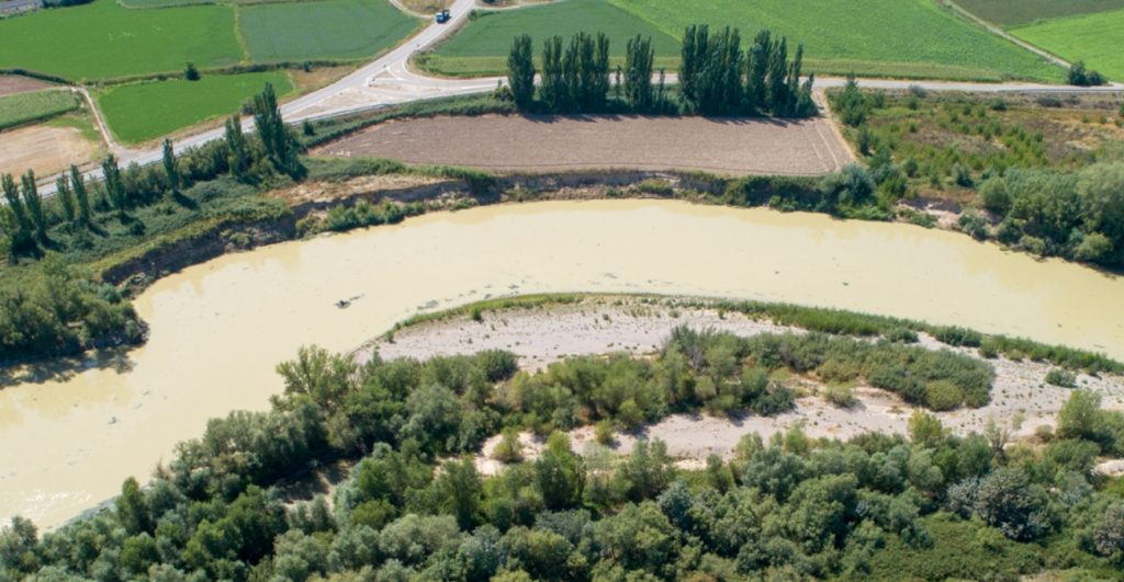
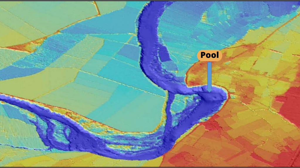
The analysis of the digital terrain model has shown that the defenses around the perimeter of the meanders have caused the channel bed to deepen as it passes through these defenses and that, by forcing the water to make the entire perimeter of the meander, the channel has been strongly eroded at the toe of the meanders.
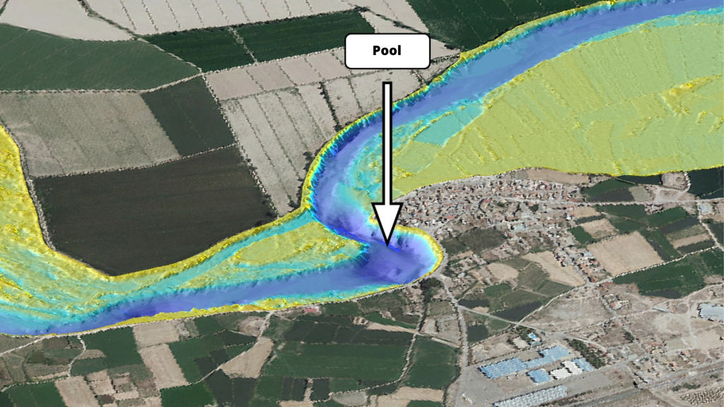
The described effect is more pronounced near the town of Cabañas de Ebro, where a pool with an average depth of 15 meters has been generated in front of the defenses of the urban center (Figure 8).
Once the hydraulic model has been configured and calibrated, the target flood is reproduced, in this case the one corresponding to a return period of 25 years, which is equivalent to a flow of 3,100 m3/s in this section, and the effects produced are analyzed.
Study of alternatives
In the simulation of the target flood (3,100 m3/It has been shown that the urban area of Cabañas de Ebro would be flooded due to a lateral overflow that would occur on the road from Alcalá to Cabañas and would move downstream through the fields until it reached the town.
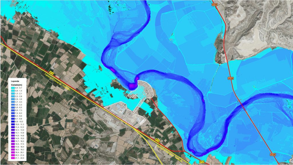
In addition, high water flow velocities were observed in the areas where erosion of the riverbed was detected, with flow velocities of over 6 m/s (21 km/h) when, for comparison, in concrete pipes, water flow velocities of over 5 m/s (18 km/h) are not recommended.
Once the data obtained have been used to determine the problems identified in advance, several alternatives with different actions are simulated. For each alternative studied, the digital terrain model is modified, incorporating the hypothetical actions to be undertaken, and the target flood is reproduced again on the modified terrain, comparing the results obtained with the previous ones and evaluating whether the expected improvement is achieved. If this is not the case, the proposal is rejected. The actions that do prove to be favorable to the objectives pursued are also simulated in a combined form, to check whether their integrated effect is more favorable, neutral or whether the proposals cancel each other out.
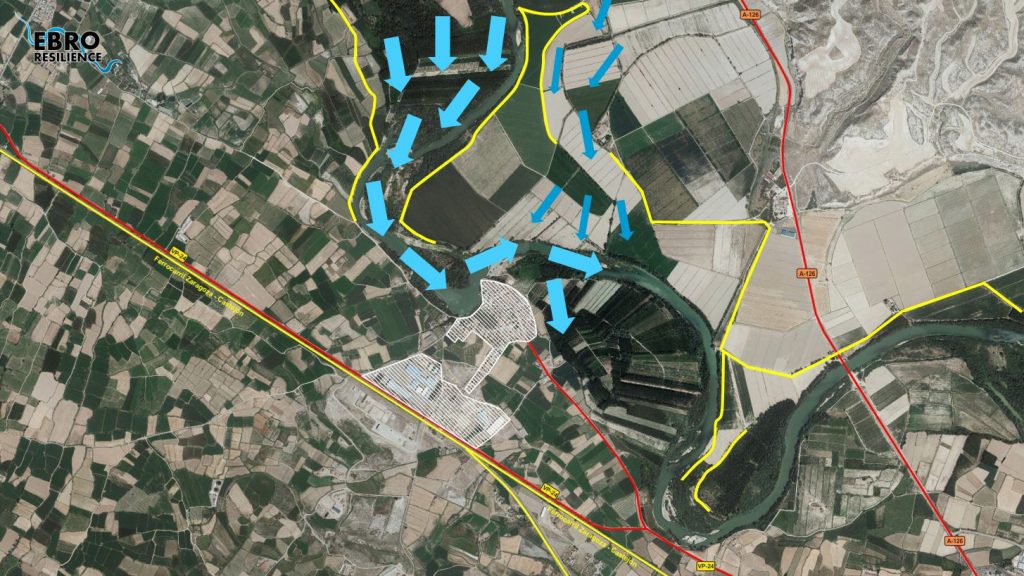
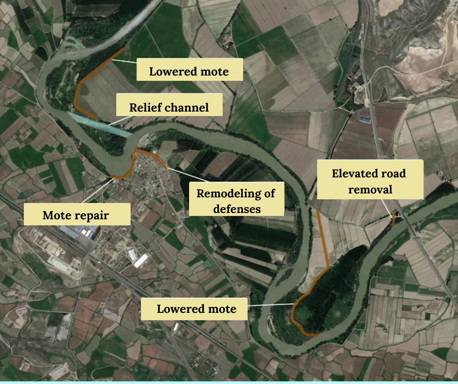
Finally, the alternative that has been shown to be the most efficient in the simulations is a combination of interventions as follows (Figure 12):
- Widening and reinforcement of the road from Alcalá to Cabañas, so as to avoid lateral overflow and its characteristics will allow inspection and emergency work to be carried out safely for operators in flood episodes, if necessary.
- Total removal of the perimeter defense mound of the meander located in front of the town, to allow it to be occupied by the waters in floods of over 1,000 m3/s.
- Construction of a new defense for the farms that would remain on the left bank, set back 800 meters.
- Construction of a relief channel in the neck of the meander in front of the urban center, which is the optimum position determined in the hydraulic simulations. This channel will be operational for flow rates of around 900 m3/s, avoiding the passage of up to 650 m3/s through the town’s defenses. It also reduces the speed at which water flows through the area of interest.
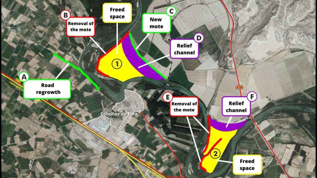
- A similar procedure would be followed in the meander located downstream of the town. First, eliminating the remains of the perimeter defenses of the meander.
- Constructing a relief channel at the neck of the meander, which directs water more efficiently towards the A-126 road bridge. This channel would be operational for flow rates in the range of 600 m3/s.
Conclusion
The alternative selected as the most efficient would avoid the lateral overflow on the road from Alcalá to Cabañas and thus the flooding of the town.
The effect of the relief channels in operation manages to limit the flows in circulation through the apexes of both meanders. In the case of the meander located upstream of the town at approximately 1,100 m3/s, and in the meander located downstream of the town at approximately 800 m3/s, which is a situation more similar to what would be natural flooding conditions in the Ebro River. This in turn reduces the speed of water circulation in areas where erosion has been detected.
The intervention would free up two large spaces, marked 1 and 2 in Figure 14, whose future uses and subsequent maintenance would have to be agreed upon with the local community.
The study has a pre-project level, being determined to select the most suitable alternatives and to allow the environmental evaluation of the proposed solutions. The definition of the exact dimensions of the actions to be carried out and their details must be included in the corresponding construction project.
The execution of these actions must be associated with a monitoring of their evolution to verify that the objectives pursued are achieved, especially the reduction of erosion processes in the face of the population’s defenses.
What’s next?
Once the detailed study of the section has been completed, participatory meetings open to the public will be held to ascertain the opinion of the population.
The corresponding adjustments will then be made to the proposal, if necessary, and the environmental processing of the interventions will begin.
Finally, the construction projects will be drawn up and each Administration will implement, within the scope of its competences, the actions for a better management of the flood risk of the corresponding section.